Today I witnessed the first launch of a weather balloon. My dad, my sister Elinor and her friend (Kate) accompanied me as we went to Intermet to get everything set up and to watch the launch. As this was a tracking training launch, the first set should have been to install their software on my laptop, so that I had a way to interface with the tracking stations, which communicated with the radiosondes trailing behind the balloon.
However, since Elinor & Kate were there, we decided to rather launch the balloon first and then install the software, so as not to keep them waiting and potentially miss the launch. So we gathered all the things needed to complete the launch, which included two radiosondes, a parachute, a Bamboo stick and some string, as the rest of the equipment was at the launch site.
The launch site was actually just a cricket field, and one of the containers on the grounds belonged to Intermet where they stored the weather balloons and the Hydrogen gas. The procedure for inflating a weather balloon was quite simple. When deflated, the balloon was roughly 50cm in diameter and had white powder all over it. The reason for this is because it is made of Latex – the white powder prevents it from sticking together and causing friction which would result in holes being created before the balloon was inflated, meaning it would burst early. In addition to the use of the powder, the deflated balloon is stretch out on a cotton mesh bed instead of the floor as cotton is non-obtrusive on the latex and cannot create holes. The balloon also has to be handled with cotton gloves, as the oils on our hands are also not great for the balloon.
Once the balloon had been lain on the cotton mesh bed and the gloves were on, I held the nozzle of the hose that led to the Hydrogen tank and inserted it into the balloon, while Michael opened the valve and let the Hydrogen fill the balloon. The balloon took about 2-3 minutes to inflate and I was surprised at how much lift it generated. Once it had been inflated, the end was tied off with a monster knot, with about 10m of string still left to trail behind. The two radiosondes were attached to each end of the bamboo stick and the leftover string was attached to the center of the bamboo.
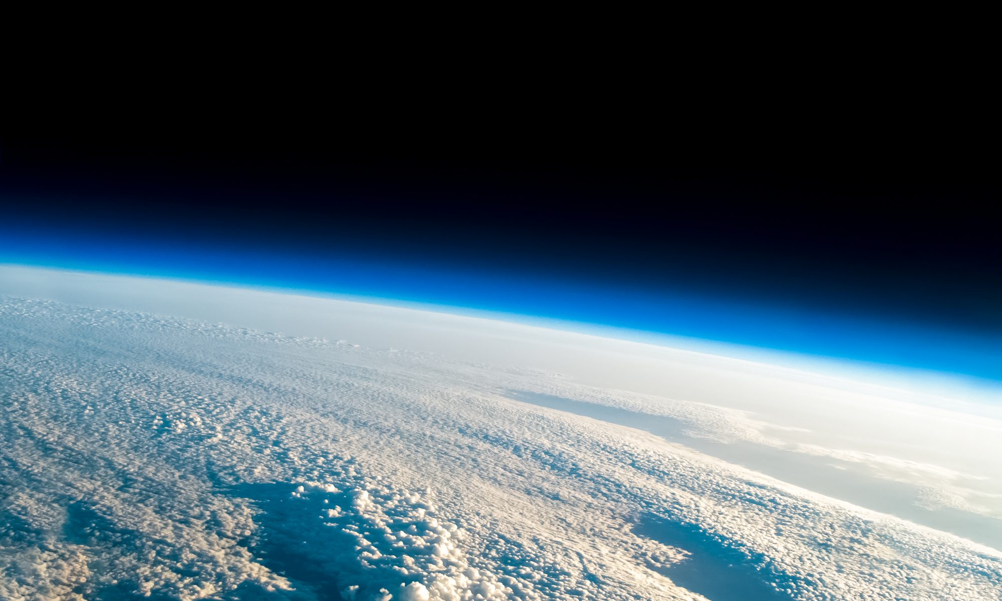
All that was left to do was to call air traffic control (ATC) and ask for permission to launch. Once permission was granted, we had to look up, make sure there was no sky traffic, and then let go. The balloon rose very quickly and started heading south, I thought it was going to go north, but apparently, most of the launches first go south, then the upper jet streams take them north and when they come down they go south again.
Once the balloon had been launched, we packed up our things and headed back to Intermet. My mom arrived just as we were leaving, so she offered to take the two girls and my dad back home so that I could focus on getting the software installed with Michael and learning how to use it.
Once back at Intermet, I went upstairs with Michael to his office and got the software installed on my computer. It is called D-MET and basically converts the obscure radio signals from the radiosondes into useable graphical data. He gave me the latest version, which is more advanced than what the SA weather service are using, along with lending me a portable tracking station that I can use in my car to track the weather balloon. The tracking station doesn’t need additional power, aside from the USB port it is plugged in to. When everything was set up, Michael suggested we go onto the roof, where we could pick up the signal the best. The software and the mini tracking station worked perfectly and I was able to track the weather balloon until it had gone behind the mountains a couple of hundred kilometers away.
Super chuffed with how the day had gone, I said my goodbyes and also said some hellos to some of the other staff who worked there. They really seem like a good bunch: pure scientists doing what they love, tinkering with electronics, playing with multimillion Rand toys and kind hearted. Those are my kind of people, so I think I will get along with them very well.
The next course of action is to actually track a payload and retrieve it safely, thereby proving that we are able to do it and that it is safe to send up cameras, as we know we will be able to retrieve them. Michael suggested I try and do that next week, depending on the weather. In the meantime, I have to come up with a better way to represent the balloon’s position, as the D-MET software stops drawing data once the balloon has burst. I am thinking of somehow interfacing it with Google Earth, but will need to investigate how to do that.


